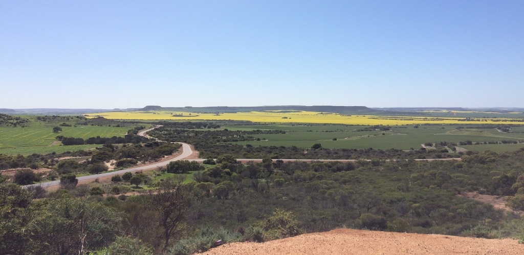
The picturesque Shire of Chapman Valley northeast of Geraldton extends from the coast of Coronation Beach, eastward to the Greenough River, north to the Rabbit Proof Fence and south to the East Chapman River. A predominately broadacre agricultural area, Chapman Valley is renowned for its magnificent flat-topped Moresby Ranges, pristine coastline and a beautiful array of wildflowers.
In 1839, when explorer Sir George Grey discovered the Chapman River during his trek south after being ship wrecked at Gantheaume Bay, at Kalbarri, he recorded positive impressions of this region. His words beautifully describe the Moresby Ranges. “A lofty chain of mountains, flat-topped, so irregular in their shape and outline that they seemed rather the work of art than of nature”. Grey named the district the “Province of Victoria”. The region would grow into a rich agricultural area that would also include economic development through the mining of copper and lead, and a limestone quarry which provided stone for the harbour works and buildings in Geraldton. The regions agriculture and resource industries together with the introduction of the railway line in 1910, saw an increase in population and further expansion to the area.
1927 vehicle registrations
The first Vehicle Registration Plates or Number Plates (on carts, motor vehicles and cycles) were issued by the Upper Chapman Road Board and bore the prefix CU…
chapman research station
The Chapman Research Station was established by the Department of Agriculture in 1902 as a demonstration farm to train recently settled local farmers…
chapman valley agricultural show
The 70th Annual Chapman Valley Agricultural Show was held the 7th September 2019…
chapman valley churches
In 1892, Michael Morrissey of the Mount Erin Estate had a rammed-earth building constructed to be used as a Catholic Church…
Hotels & Taverns
The first Hotel in Nabawah, the Mining Arms, opened in 1889, was built by Samuel Hadley Jupp. It was a place for travellers, miners and the shepherds…
protheroe
Copper was first mined at Narra Tarra (meaning ‘hill camp’) on Michael Morrisey’s Mt Erin pastoral lease from 1863 to 1866…
mt erin station
Michael Morrissey arrived at Fremantle on the “Ganges” in 1841, from Waterford, Ireland. He first took up work as a shepherd, near York…
mt erin rifle club
Rifle shooting was a popular attraction in the early days of the valley. The local detachment of 10th Light Horse Volunteers used a range on the east side of Poison Hill as did other local people.
upper chapman railway line
The Wokarina to Yuna railway line was a branch of the Geraldton to Northampton line…
upper chapman road board
From its inception in 1901 the Upper Chapman Road Board held its meetings in Michael Morrissey’s small rammed earth building which was also used as the school…
Victory brickworks
A brick kiln stood on the North West bank of the Chapman River, north of Eastough’s homestead at ‘Glendoone’.
upper chapman schools
When settlers could claim to have ten or more school age children within three miles of a centre, they were entitled to apply for a school…
yetna plane crash
During World War 2 many people were able to recognise types of aircraft, not only by sight but by their distinctive sounds …
the town of nanson
Nanson is a small town in the Mid West region of Western Australia, 30klms northeast of Geraldton and situated on the banks of the Chapman River…
the town of Nabawa
Nabawa is the main centre of the Shire of Chapman Valley, and where a new Shire Office was built in 1967…
the town of yuna
Yuna is an Aboriginal word meaning “stinking water”. For a long time, the only available water was a rock soak at Whelarra…